 One of the most intriguing tales of the discovery of ruins of a lost civilization is the story of Dr. Ray Brown. In 1970, while diving near the Bari Islands in the Bahamas, Dr. Brown claimed to have come across a pyramid "shining like a mirror" that he estimated was 120 feet tall, although he could see only the top 90 feet. The pyramid had a colored capstone and was surrounded by the ruins of other buildings. Swimming into a chamber he found a crystal held by two metallic hands. Over the crystal hung a brass rod from the center of the ceiling, at the end of which was a red multifaceted gem of some kind. Brown said he took the crystal, which allegedly has strange, mystical powers.
 Brown's story sounds fictitious - it's just too spectacular. But it excites the imagination and wonder about all the mysteries that could be down there - lost worlds awaiting rediscovery.
 A 'lost city', that could turn out to be the fabled city of Atlantis, has been located by a Canadian scientific research team. In a press release dated Havana, 14 May 2001 Reuters of London informed the world that Soviet-born ocean engineer Paulina Zelitsky, the president of Canadian-based company Advanced Digital Communications, had detected 'a sunken city' in deep waters off the west coast of Cuba, the largest island of the Caribbean. Satellite-integrated ocean bottom positioning systems, echo sounders and high precision side-scan double-frequency sonar have detected the presence of what are being described as 'shapes' that 'resemble pyramids, roads and buildings'. Their regularity seems consistent with the idea that they represent an 'urban development' composed of 'symmetrical architecture'. Reuters reported that the deep-sea city is located on a huge land plateau lying in around 2,200 feet (700 metres) of water. Furthermore, that in Paulina's opinion the complex belongs to 'the pre-classic period' of Central American history, and was populated by 'an advanced civilization similar to the early Teotihuacán culture of Yucatán'. 'It is stunning,' she said during an interview with the Reuters representative at her office at Tarara, on the coast east of Havana. 'What we see in our high-resolution sonar images are limitless, rolling, white sand plains and, in the middle of this beautiful white sand, there are clear man-made large-size architectural designs. It looks like when you fly over an urban development in a plane and you see highways, tunnels and buildings. 'We don't know what it is, and we don't have the videotaped evidence of this yet, but we do not believe that nature is capable of producing planned symmetrical architecture, unless it is a miracle,' she added. Paulina is cautious about what lies beneath the glistening blue waters of the Yucatán Channel, admitting
 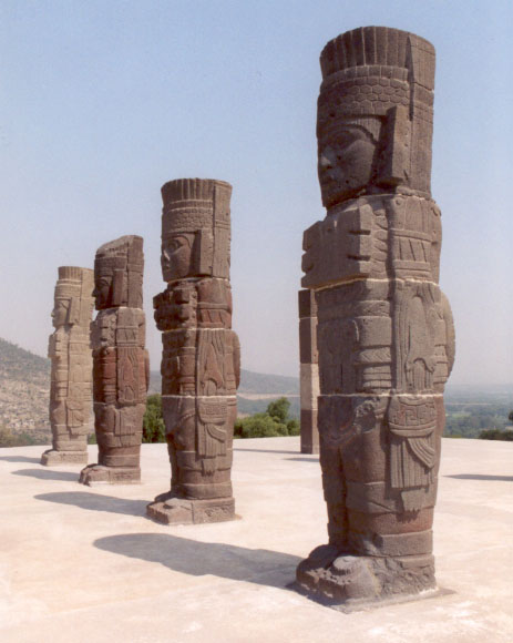 only that she is 'excited but reluctant to speculate until a joint investigation with the Cuban Academy of Sciences and the National Geographic Society takes place early this summer.' The discoveries were made last summer during deep-sea surveys made by Paulina and a trained scientific research team aboard the Cuban research vessel Ulises. Sonar images revealed 'an extensive series of structures' over a several-mile area in darker and lighter shades. The site is close to the edge of the underwater geological feature known as the Cuban shelf, which falls off sharply in a series of shelves which drop down to several thousand metres, and it is on one of these shelves, in around 600-700 metres of water, that the structures are to be found. The mass of rectilinear features are said to be located in the proximity of an 'extinct volcano, geological faults and a river bed'. This last fact alone shows that the land shelf, which rises to a height of around 40 metres, was once above water. 'Whenever you find a volcano, there is often a settlement associated with it,' Paul Weinzweig, Paulina's husband and a director of ADC, observed. 'I don't know the exact relationship, but it is in the same vicinity as the volcano, the fault lines and the river. They're quite close to one another.' On the matter of whether the sonar imagery really does show 'pyramids, roads and buildings', Paul stated: 'We had been looking at the images for some months, and keep a picture on the wall showing
  pyramids in the Yucatán, and let's just say they kept reminding us of these structures. They really do look like an urban development.' As to whether the light and dark areas of the sonar imagery appear to be three-dimensional features or not, he answered: 'There's a lot of symmetry, apart from actual shapes, and some suggestion of structure. Some American geologists have looked at them and said that the darker shadings are suggestive of metal roofing.' In order to explore the site more closely, ADC are currently planning to send down remote robot video cameras and a one-man submersible. We therefore look forward to further news of these discoveries in the coming months.
The Search for Sunken Vessels
ADC's intentions had never been to search for sunken cities. Their scientific operation to survey the deep waters off the Cuban coastline forms part of a joint venture set up between the Canadian company and the Cuban government, in particular its state partner Geomar. One of
 their principal aims is the location of the billions of dollars of bullion and lost treasure disgorged from sunken ships since the time of the Conquest. As Paul said: 'Cuba has the richest galleon cemetery in the world.' Over the past 500 years it is estimated that hundreds, if not thousands, of vessels must have been lost in Cuban waters due poor navigation, piracy on the high seas and the violent Caribbean storms that plague the region on a frighteningly regular basis. Visa Gold, a Toronto-based low-tech company which operates out of Havana's Marina Hemingway, claims already to have found some 7,000 objects from sunken vessels. They include jewellery, diamonds and pistols, said to have come from a brigantine called Palemon, lost off Cuba's northern coast in 1839. Visa Gold's next target is the Atocha y San Jose, a Spanish vessel. It sank in Havana Bay in
  January 1642 after fleeing storms at sea. The renewed interest in treasure salving in Cuban coastal waters comes in the wake of Fidel Castro's government recognising the fact that it does not have the ocean expertise or the inclination to conduct scientific operations of this nature. Its divers, who are considered to be among the best in the world, have been diving off Cuba's coast treasure hunting for decades. Yet Cuba lacks expertise and technology for deep-ocean search and science, which is why they have invited ADC to take up the challenge. Their 80-metre oceanographic reseach vessel, the Ulises, uses high-tech equipment and a highly trained scientific team to survey the ocean bottom up to a depth of several thousand metres. It was their high-skilled sonar software analysts who detected the reported underwater remains in the Yucatán Channel. 'These projects are very important in helping us rescue things from history, which contribute to our national patrimony,' said Eddy Fernandez, vice president of Geomar. 'As you know, we have financing problems. This is a very expensive activity. They give us technology and financing. We provide historical and ocean expertise'.
THE CUBA-ATLANTIS ARGUMENT
The implications of ADC's discoveries off Cuba's western coastline are far reaching and quite extraordinary. In an on-line pole, conducted by the NBC home news service MSNBC, of the 1827 people who had voted by the end of 26 May 2001, no less than 73 percent believed that the find 'could be something big: Next stop, Atlantis'. It means that already NBC are considering the possibility that the sunken city could be linked with Plato's account of the lost city of Atlantis. This is good news for me, as my book GATEWAY TO ATLANTIS, published in 2000, concluded that the most likely location of Plato's sunken empire was Cuba, the first time that this country had ever been proposed in this respect. I pointed out that the evidence contained in Plato's works the TIMAEUS and CRITIAS hinted strongly that his view of Atlantis was based on stories and rumours reaching the ancient world via Phoenician and Carthaginian who were crossing the
 Atlantic prior to his age. Moreover, Plato's description of Atlantis' great plain, said to have been 3000 by 2000 stadia (552 by 368 kilometres) in size, matches very well Cuba's great western plain. Before the rapid rise in sea-level following the end of the last Ice Age this stretched southwards across the Bay of Batabanó to the mysterious Isle of Youth and was originally 540 by 160 kilometres in size. Although I speculated in the book - which has now been published in the USA, Italy, Holland, Germany and Portugal - that the Atlantean city might await discovery beneath the shallow waters of the Bay of Batabanó, news that a sunken city may now have been detected in the Yucatán Channel, between Cuba and the Yucatán peninsular, is exciting news. Incidentally, ADC have plans to explore the Bay of Batabanó during the next year, so it should be interesting to see what if anything they find here.
The Search for the Mother Lode
 In September 1972 American oceanic explorer J. Manson Valentine, flying over the Bahamas in a light aircraft with and his associate Jim Richardson, noticed a mass of rectilinear and curvilinear features in shallow waters on the south-western edge of the former Bahaman landmass (now the Great Bahama Bank). Valentine referred to this mass of possible archaeological features as 'the mother lode'. They faced out across the Old Bahama Channel, like some kind of ancient port serving the Cuban mainland. As early as the 1950s light-aircraft pilots reported seeing what they described as underwater 'stonework' which was 'well within Cuban waters'. Similar sightings 'north of Cuba' of an alleged 'submerged building complex covering over ten acres' might even have convinced the Cuban government that a veritable city awaited discovery in its vigorously defended waters. There are, for instance, unconfirmed reports that this 'building complex' was explored with the assistance of Soviet submarines based in Cuba during the 1960s. Strange then that these recent discoveries of a sunken city in Cuban waters are being conducted by a Russian-born Canadian oceanographer. Among those who felt they had glimpsed the remains of a lost citadel in Cuban waters was Leicester Hemingway, brother of the writer Ernest Hemingway. During a flight into the country, Leicester noticed, beyond its northern coast, 'an expanse of stone ruins, several acres in area and apparently white, as if they were marble'. The exact location of these underwater features remains unclear. Only time will tell whether the discoveries made by Paulina Zelitsky and ADC do constitute firm evidence of Plato's Atlantis, for if they do then it will fix, once and for all, its geographical location in the Bahamas and Caribbean, and not anywhere else in the world. However, the location of a lost city on a huge land plateau lying at a depth of around 600-700 metres poses new problems for the Atlantis debate. Plato wrote that his Atlantic island empire was destroyed by 'earthquakes and floods' in 'one terrible day and night', post-8570 BC in the TIMAEUS and around 9421 BC in the CRITIAS. This time-frame corresponds with the cessation of the last Ice Age, when we know that the sea-levels began to rise fairly rapidly as the ice fields which had covered vast areas of North America and Europe for tens of thousands of years began to disappear. In GATEWAY TO ATLANTIS I proposed that the mechanism behind Atlantis' destruction was a comet impact which devastated the eastern Atlantic coast of America, causing literally 500,000 elliptical craters, known today as the Carolina Bays, sometime around 8500 BC (+/- 500 years). Fragments of the comet falling in the Western Atlantic basin, north of the Bahamas, would have created tsunami tidal-waves perhaps hundreds of metres high. These would have drowned, temporarily at least, large parts of the Bahamas and Caribbean, as well as many low-lying regions of the eastern United States. Myths and legends told by the indigenous peoples of the Bahaman and Caribbean archipelagos, when the Spanish first reached the New World, spoke of just such a cataclysm. They said that the waters suddenly rushed in and drowned the great landmass, breaking it up into the individual islands seen today. Although a fragmentation of the former landmasses of the Bahamas and Caribbean in the manner indicated could not have been caused by tsunamis alone, the gradual rise in the sea-level which followed this cataclysmic event would have drowned, more permanently this time, all low-lying regions, creating the archipelagos we see today. Yet in the thousands of years which it took for the ice fields to melt in full, the sea-level rose only 300 metres (some estimates place it as much as 400 metres). If the 'city' does lie in 600-700 metres of water, we will need to propose a suitable geological mechanism in order to justify its submergence to this depth post 9000 BC. Either that, or we will have to define a geological time-frame in which the land plateau, with its volcano, fault lines and river was above sea-level. Paulina's statement that the 'city' might belong to 'the pre-classic period' of Mesoamerican history, and was populated 'by an advanced civilisation similar to the early Teotihuacán culture of Yucatán', is very difficult to equate with the discovery. The Teotihuacán culture, which thrived in Central Mexico from around 400 BC through until around AD 500, remains an enigma to archaeologists. Its origin is unclear. What we do know is that legends once told by the Totonac peoples of eastern Mexico spoke of the founders of its sacred city of Teotihuacán, with its mighty Pyramids of the Sun and Moon, as having arrived on the Gulf coast from an island homeland which lay beyond the sea. Here was to
  be found Chicomoztoc, the Seven Caves, where the first humans emerged out of the darkness at the beginning of time. For many reasons, not least of all the appearance of sea-shells of a purely Caribbean nature carved on the walls of the Temple of Quetzalcoatl at Teotihuacán, the Teotihuacán culture saw their ancestral homeland as connected in some way with the Caribbean. Moreover, in GATEWAY TO ATLANTIS I identified the original Seven Caves complex as the Punta del Esté caves on Cuba's Isle of Youth, one of which, Ceuva # 1, has been described as a veritable Sistine Chapel of the prehistoric world. Many thousands of years ago unknown artists adorned its walls and ceilings with abstract petroglyphs of a blatantly celestial nature. Yet even so, any sunken city lying off the northern coast of Cuba, in 600-700 metres of water, must antedate the Teotihuacán culture by many thousands of years. Curiously, Pauline Zelitsky visited Ceuva # 1 at the Punta del Esté complex
  during the summer of 2000, shortly before she made her dramatic discovery of the underwater 'city'. There is something magical about this place. It assaults the senses and inspires thoughts regarding the origins of Cuba's indigenous peoples and their apparent knowledge of the cataclysm which devastated the region so many thousands of years ago. If Paulina Zelitsky and her oceanographic colleagues are right in their belief that 'pyramids, roads and buildings' do lie off Cuba's western coastline, then it is clear that the prehistory of the Caribbean, and its influence on the rise of Mesoamerican civilisation, will have to be revised dramatically. Moreover, it could well be that at long last the mystery of Atlantis, mankind's greatest historical enigma, is about to unfold in a most spectacular fashion. Sources: 'Looking for lost riches in Cuba's seas: Underwater surveyors say they may have found sunken city', Reuters report dated Havana, 14 May, 2001, Collins, Andrew, GATEWAY TO ATLANTIS, Headline, London, 2000; Carroll & Graf, USA, 2000.
No comments:
Post a Comment