Monday, April 13, 2009

Chinese seals

The role of seals in the Chinese culture can hardly be overestimated. For the last 3,000 years they have been used in official, private, even magic spheres. The earliest examples of seals come from the Shang dynasty (BCE 16-11 c.) from the archeological sites at Anyang. However very little is known about their usage at this early stage, it is only starting from the Spring and Autumn period (BCE 722-481) that we begin to see an increased quantity of seals paired with textual references to them. According to a Han dynasty story, the first seal was given to the Yellow Emperor by a yellow dragon with a chart on its back. Another story says that it was given to Emperor Yao by a phoenix as the emperor was sitting in a boat. In any case, the receipt of the seal signifies the conferral of the Mandate of Heaven. He who has the seal possesses the Mandate of Heaven, in other words, he has been given the right to rule the empire. So when Tang, the first ruler of the Shang dynasty overthrows the last tyrant of the previous Xia dynasty, he seizes the royal seal and thus establishes his power.

Imperial seals

Until the end of Warring States period (BCE 403-221), there was only one way of calling seals, both official and private, regardless of their use and material. This name was xi, which in the following periods gradually became the designation for imperial seals. According to the History of Tang dynasty, Empress Wu (634-705) issued an order to change the word xi, which was up until then used for imperial seals, to bao (treasure). Apparently, she disliked the fact that the word xi was close in sound to the si (death). But when Emperor Zhongzong resumed the throne in 705, he changed the name for imperial seals back to xi. In subsequent centuries the two words were alternated, depending on the period.

At the time of the Han dynasty, the emperor had six seals, during the Tang he had eight, during the Ming over a dozen, and by the time of the Qing, there were several dozens of official imperial seals. The inscription on these official seals usually refers to receiving the Mandate of Heaven or being the successor of Heaven.

Another type of imperial seal was a seal that the emperor used to indicate that a certain document was written in his own handwriting. Emperor Qianlong (1736-1795) for example, was famous for his literary ambitions, including calligraphy, and had produced a large amount of texts affixed with his seal. When his calligraphy was carved into stone steles, the seal was copied onto the surface of the stone too.

Yet another seal was used by the emperors to appraise and appreciate art. It was customary for collectors and connoisseurs of art to affix their seals on the surface of a scroll of painting or calligraphy. The paintings acquired by the imperial household were affixed by the imperial seal. Many famous paintings from the Forbidden City have seals of generations of subsequent emperors on them.

Official seals

Official seals have been conferred to officials as a token of their office and authority. These seals were usually small enough to be carried on the official's belt. There were regulations as to the material and shape of the handle of these seals: some had to be golden, some copper, some with a handle in the shape of a turtle, some of a camel. Up to the Eastern Han dynasty (25-330), the color of ink used to affix official seals was regulated depending on the position of the owner, some officials had to use green ink, some purple, some yellow etc.

The calligraphy of the inscription had changed a great deal over the long span of Chinese history. Approaching the Han dynasty, the characters on the seal inscriptions tend to become thicker and more angular. From the Sui dynasty (581-618), they become rounded and thinner, and during the Song and Yuan periods we can witness the spectacular jiudie (nine-folded) script. In the Qing period, most official seals are bilingual with the Chinese inscription on the right side and the Manchu on the left.

Private seals

Private seals are naturally unregulated, therefore they show the largest variety in content, shape, size, material and calligraphy. Despite of their varied characteristics, they can still be categorized based on their use.

Seals with names, pen names, pseudonyms etc on them were used as a signature by people in their private life. This is how artists sign their works and letters. Chinese literati commonly used a number of different pen names so identifying a person's name from a seal can be a tricky business.

Collector seals were mainly used for the purpose of authenticating pieces of art. Thus a seal of a famous collector or connoisseur would become an integral part of a work of art and could substantially raise its value. Thus in the course of several centuries, some Chinese paintings became covered by a dozen of different seals.

The rest of private seals can be conveniently categorized under the umbrella term "leisure seals". The inscription on these seals is usually a short text which is either a quote from a famous writing or just some saying that the owner thought important. Typical inscriptions are "Respect fate", "Attain wisdom", "Respect", "Use loyalty and humanity in your affairs" etc. One could compare these seals to signatures with a quote at the end of email messages where the people append some saying they consider valuable at the end of their message.

Ancient Egyptian Flying Vehicles

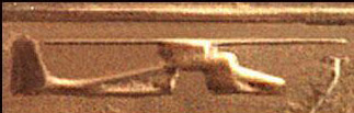
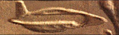
These images were found on the ceiling beams of a 3000-year old New Kingdom Temple, located several hundred miles south of Cairo and the Giza Plateau, at Abydos.

Many researchers into the UFO enigma tend to overlook a very important fact. While it assumed that most flying saucers are of alien, or perhaps Governmental Military origin, another possible origin of UFOs is ancient India and Atlantis.

What we know about ancient Indian flying vehicles comes from ancient Indian sources; written texts that have come down to us through the centuries.

There is no doubt that most of these texts are authentic; many are the well known ancient Indian Epics themselves, and there are literally hundreds of them. Most of them have not even been translated into English yet from the old sanskrit.

The Indian Emperor Ashoka started a "Secret Society of the Nine Unknown Men": great Indian scientists who were supposed to catalogue the many sciences. Ashoka kept their work secret because he was afraid that the advanced science catalogued by these men, culled from ancient Indian sources, would be used for the evil purpose of war, which Ashoka was strongly against, having been converted to Buddhism after defeating a rival army in a bloody battle.

The "Nine Unknown Men" wrote a total of nine books, presumably one each. Book number was "The Secrets of Gravitation!" This book, known to historians, but not actually seen by them dealt chiefly with "gravity control."

It is presumably still around somewhere, kept in a secret library in India, Tibet or elsewhere (perhaps even in North America somewhere). One can certainly undertand Ashoka's reasoning for wanting to keep such knowledge a secret, assuming it exists. if the Nazis had such weapons at their disposal during World War Ii. Ashoka was also aware devastating wars using such advanced vehicles and other 'futuristic weapons' that had destoryed the ancient Indian "Rama Empire" several thousand years before.

Only a few years ago, the Chinese discovered some sanskrit documents in Lhasa, Tibet and sent them to the University of Chandrigarh to be translated. Dr. Ruth Reyna of the University said recently that the documents contain directions for building interstellar spaceships!

Their method of propulsion, she said, was "anti-gravitational" and was based upon a system analogous to that of "laghima," the unknown power of the ego existing in man's physiological makeup, "a centrifugal force strong enough to counteract all gravitational pull." According to Hindu Yogis, it is this "laghima" which enables a person to levitate.

Dr. Reyna said that on board these machines, which were called "Astras" by the text, the ancient Indians could have sent a detachment of men onto any planet, according to the document, which is thought to be thousands of years old.

The manuscripts were also said to reveal the secret of "antima"; "the cap of invisibility" and "garima"; "how to become as heavy as a mountain of lead."

Naturally, Indian scientists did not take the texts very seriously, but then became more positive about the value of them when the Chinese announced that they were including certain parts of the data for study in their space program!

This was one of the first instances of a government admitting to be researching anti-gravity.

The manuscripts did not say definitely that interplanetary travel was ever made but did mention, of all things, a planned trip to the Moon, though it is not clear whether this trip was actually carried out. However, one of the great Indian epics, the Ramayana, does have a highly detailed story in it of a trip to the moon in a Vimana (or "Astra"), and in fact details a battle on the moon with an "Asvin" (or Atlantean" airship.

This is but a small bit of recent evidence of anti-gravity and aerospace technology used by Indians. To really understand the technology, we must go much further back in time.

The so-called "Rama Empire" of Northern India and Pakistan developed at least fifteen thousand years ago on the Indian sub-continent and was a nation of many large, sophisticated cities, many of which are still to be found in the deserts of Pakistan, northern, and western India.

Rama existed, apparently, parallel to the Atlantean civilization in the mid-Atlantic Ocean, and was ruled by "enlightened Priest-Kings" who governed the cities, The seven greatest capital cities of Rama were known in classical Hindu texts as "The Seven Rishi Cities."

According to ancient Indian texts, the people had flying machines which were called "Vimanas." The ancient Indian epic describes a Vimana as a double-deck, circular aircraft with portholes and a dome, much as we would imagine a flying saucer.

It flew with the "speed of the wind" and gave forth a "melodious sound." There were at least four different types of Vimanas; some saucer shaped, others like long cylinders ("cigar shaped airships").

The ancient Indian texts on Vimanas are so numerous, it would take volumes to relate what they had to say. The ancient Indians, who manufactured these ships themselves, wrote entire flight manuals on the control of the various types of Vimanas, many of which are still in existence, and some have even been translated into English.

The Samara Sutradhara is a scientific treatise dealing with every possible angle of air travel in a Vimana. There are 230 stanzas dealing with the construction, take-off, cruising for thousand of miles, normal and forced landings, and even possible collisions with birds.

In 1875, the Vaimanika Sastra, a fourth century B.C. text written by Bharadvajy the Wise, using even older texts as his source, was rediscovered in a temple in India.

It dealt with the operation of Vimanas and included information on the steering, precautions for long flights, protection of the airships from storms and lightening and how to switch the drive to "solar energy" from a free energy source which sounds like "anti-gravity."

The Vaimanika Sastra (or Vymaanika-Shaastra) has eight chapters with diagrams, describing three types of aircraft, including apparatuses that could neither catch on fire nor break.

It also mentions 31 essential parts of these vehicles and 16 materials from which they are constructed, which absorb light and heat; for which reason they were considered suitable for the construction of Vimanas.

This document has been translated into English and is available by writing the publisher: VYMAANIDASHAASTRA AERONAUTICS by Maharishi Bharadwaaja, translated into English and edited, printed and published by Mr. G. R. Josyer, Mysore, India, 1979 (sorry, no street address). Mr. Josyer is the director of the International Academy of Sanskrit Investigation located in Mysore.

There seems to be no doubt that Vimanas were powered by some sort of "anti-gravity." Vimanas took off vertically, and were capable of hovering in the sky, like a modern helicopter or dirigible. Bharadvajy the Wise refers to no less than 70 authorities and 10 experts of air travel in antiquity. These sources are now lost.

Vimanas were kept in a Vimana Griha, a kind of hanger, and were sometimes said to be propelled by a yellowish-white liquid, and sometimes by some sort of mercury compound, though writers seem confused in this matter. It is most likely that the later writers on Vimanas, wrote as observers and from earlier texts, and were understandably confused on the princible of their propulsion.

The "yellowishwhite liquid" sounds suspiciously like gasoline, and perhaps Vimanas had a number of different propulsion sources, including combustion engines and even "pulse-jet" engines.

It is interesting to note, that the Nazis developed the first practical pulse-jet engines for their V-8 rocket "buzz bombs." Hitler and the Nazi staff were exceptionally interested in ancient India and Tibet and sent expeditions to both these places yearly, starting in the 30's, in order to gather esoteric evidence that they did so, and perhaps it was from these people that the Nazis gained some of their scientific information!

According to the Dronaparva, part of the Mahabarata, and the Ramayana, one Vimana described was shaped like a sphere and born along at great speed on a mighty wind generated by mercury. It moved like a UFO, going up, down, backwards and forewards as the pilot desired.

In another Indian source, the Samar, Vimanas were "iron machines, well-knit and smooth, with a charge of mercury that shot out of the back in the form of a roaring flame."

Another work called the Samaranganasutradhara describes how the vehicles were constructed. It is possible that mercury did have something to do with the propulsion, or more possibly, with the guidance system.

Curiously, Soviet scientists have discovered what they call "age-old instruments used in navigating cosmic vehicles" in caves in Turkestan and the Gobi Desert. The "devices" are hemispherical objects of glass or porcelain, ending in a cone with a drop of mercury inside.

It is evident that ancient Indians flew around in these vehicles, all over Asia, to Atlantis presumably; and even, apparently, to South America.

Writing found at Mohenjodaro in Pakistan (presumed to be one of the "Seven Rishi Cities of the Rama Empire") and still undeciphered, has also been found in one other place in the world: Easter Island! Writing on Easter Island, called Rongo-Rongo writing, is also undeciphered, and is uncannily similar to the Mohenjodaro script.

Was Easter Island an air base for the Rama Empire's Vimana route? (At the Mohenjo-Daro Vimana-drome, as the passenger walks down the concourse, he hears the sweet, melodic sound of the announcer over the loudspeaker,

"Rama Airways flight number seven for Bali, Easter Island, Nazca, and Atlantis is now ready for boarding.

Passengers please proceed to gate number..") in Tibet, no small distance, and speaks of the "fiery chariot" thusly: "Bhima flew along in his car, resplendent as the sun and loud as thunder... The flying chariot shone like a flame in the night sky of summer ... it swept by like a comet... It was as if two suns were shining. Then the chariot rose up and all the heaven brightened."

In the Mahavira of Bhavabhuti, a Jain text of the eighth century culled from older texts and traditions, we read: "An aerial chariot, the Pushpaka, conveys many people to the capital of Ayodhya.

The sky is full of stupendous flying-machines, dark as night, but picked out by lights with a yellowish glare-"

The Vedas, ancient Hindu poems, thought to be the oldest of all the Indian texts, describe Vimanas of various shapes and sizes: the "ahnihotra-vimana" with two engines, the "elephant-vimana" with more engines, and other types named after the kingfisher, ibis and other animals.

Unfortunately, Vimanas, like most scientific discoveries, were ultimately used for war.

Atlanteans used their flying machines, 'Vailixi'. a similar type of aircraft, to literally try and subjugate the world, it would seem, if Indian texts are to be believed.

The Atlanteans, known as "Asvins" in the Indian writings, were apparently even more advanced technologically than the Indians, and certainly of a more war-like temperment. Although no ancient texts on Atlantean Vailixi are known to exist, some information has come down through esoteric, "occult" sources which describe their flying machines.

Similar, if not identical to Vimanas, Vailixi were generally "cigar shaped" and had the capability of manuvering underwater as well as in the atmosphere or even outer space.

Other vehicles, like Vimanas, were saucer shaped, and could apparently also be submerged.

According to Eklal Kueshana, author of "The Ultimate Frontier," in an article he wrote in 1966, Vailixi were first developed in Atlantis 20,000 years ago, and the most common ones are "saucershaped of generally trapezoidal cross-section with three hemispherical engine pods on the underside." "They use a mechanical antigravity device driven by engines developing approximately 80,000 horse power."

The Ramayana, Mahabarata and other texts speak of the hideous war that took place, some ten or twelve thousand years ago between Atlantis and Rama using weapons of destruction that could not be imagined by readers until the second half of this century.

The ancient Mahabharata, one of the sources on Vimanas, goes on to tell the awesome destructiveness of the war:

"...(the weapon was) a single projectile charged with all the power of the Universe. An incandescent column of smoke and flame As bright as the thousand suns rose in all its splendor... An iron thunderbolt, a gigantic messenger of death, which reduced to ashes the entire race of the Vrishnis and the Andhakas. . . . the corpses were so burned as to be unrecognizable. The hair and nails fell out; Pottery broke without apparent cause, and the birds turned white. .. After a few hours all foodstuffs were infected...to escape from this fire the soldiers threw themselves in streams to wash themselves and their equipment..."

It would seem that the Mahabharata is describing an atomic war! References like this one are not isolated; but battles, using a fantastic array of weapons and aerial vehicles are common in all the epic Indian books.

One even describes a Vimana-Vailix battle on the Moon! The above section very accurately describes what an atomic explosion would look like and the effects of the radioactivity on the population. Jumping into water is the only respite.

When the Rishi City of Mohenjodaro was excavated by archeologists in the last century, they found skeletons just lying in the streets, some of them holding hands, as if some great doom had suddenly overtaken them.

These skeletons are among the most radioactive ever found, on a par with those found at Hiroshima and Nagasaki.

Ancient cities whose brick and stone walls have literaly been vitrified, that is-fused together, can be found in India, Ireland, Scotland, France, Turkey and other places.

There is no logical explanation for the vitrification of stone forts and cities, except from an atomic blast.

Futhermore, at Mohenjo-Daro, a well planned city laid on a grid, with a plumbing system superior to those used in Pakistan and India today, the streets were littered with "black lumps of glass."

These globs of glass were discovered to be clay pots that had melted under intense heat!

With the cataclysmic sinking of Atlantis and the wiping out of Rama with atomic weapons, the world collapsed into a "stone age" of sorts, and modern history picks up a few thousand years later. Yet, it would seem that not all the Vimanas and Vailixi of Rama and Atlantis were gone.

Built to last for thousands of years, many of them would still be in use, as evidenced by Ashoka's "Nine Unknown Men" and the Lhasa manuscript.

That secret societies or "Brotherhoods" of exceptional, "enlightened" human beings would have preserved these inventions and the knowledge of science, history, etc., does not seem surprising.

Many well known historical personages including Jesus, Buddah, Lao Tzu, Confucious, Krishna, Zoroaster, Mahavira, Quetzalcoatl, Akhenaton, Moses, and more recent inventors and of course many other people who will probably remain anonomous, were probably members of such a secret organization.

It is interesting to note that when Alexander the Great invaded India more than two thousand years ago, his historians chronicled that at one point they were attacked by "flying, fiery shields" that dove at his army and frightened the cavalry.


These "flying saucers" did not use any atomic bombs or beam weapons on Alexander's army however, perhaps out of benevolence, and Alexander went on to conquer India.

It has been suggested by many writers that these "Brotherhoods" keep some of their Vimanas and Vailixi in secret caverns in Tibet or some other place is Central Asia, and the Lop Nor Desert in western China is known to be the center of a great UFO mystery.

Perhaps it is here that many of the airships are still kept, in underground bases much as the Americans, British and Soviets have built around the world in the past few decades.

Still, not all UFO activity can be accounted for by old Vimanas making trips to the Moon for some reason. Undoubtedly, some are from the Military Governments of the world, and possibly even from other planets.

Of course, many UFO sightings are "swamp, gas, clouds, hoaxes, and hallucinations, while there is considerable evidence that many UFO sightings, especially "kidnappings" and the like, are the result of what is generally called "telepathic hypnosis."

One common thread that often runs between "Alien kidnappings," "sex with aliens," and other "close encounters of a third kind" is a buzzing in the ears just before the encounter.

According to many well informed people, this is a sure sign of telepathic hypnosis.


source 1 2

Tuesday, April 7, 2009

The Hanging Gardens of Babylon

Some stories indicate the Hanging Gardens towered hundreds of feet into the air, but archaeological explorations indicate a more modest, but still impressive, height...

The ancient city of Babylon, under King Nebuchadnezzar II, must have been a wonder to the traveler's eyes. "In addition to its size," wrote Herodotus, a historian in 450 BC, "Babylon surpasses in splendor any city in the known world."

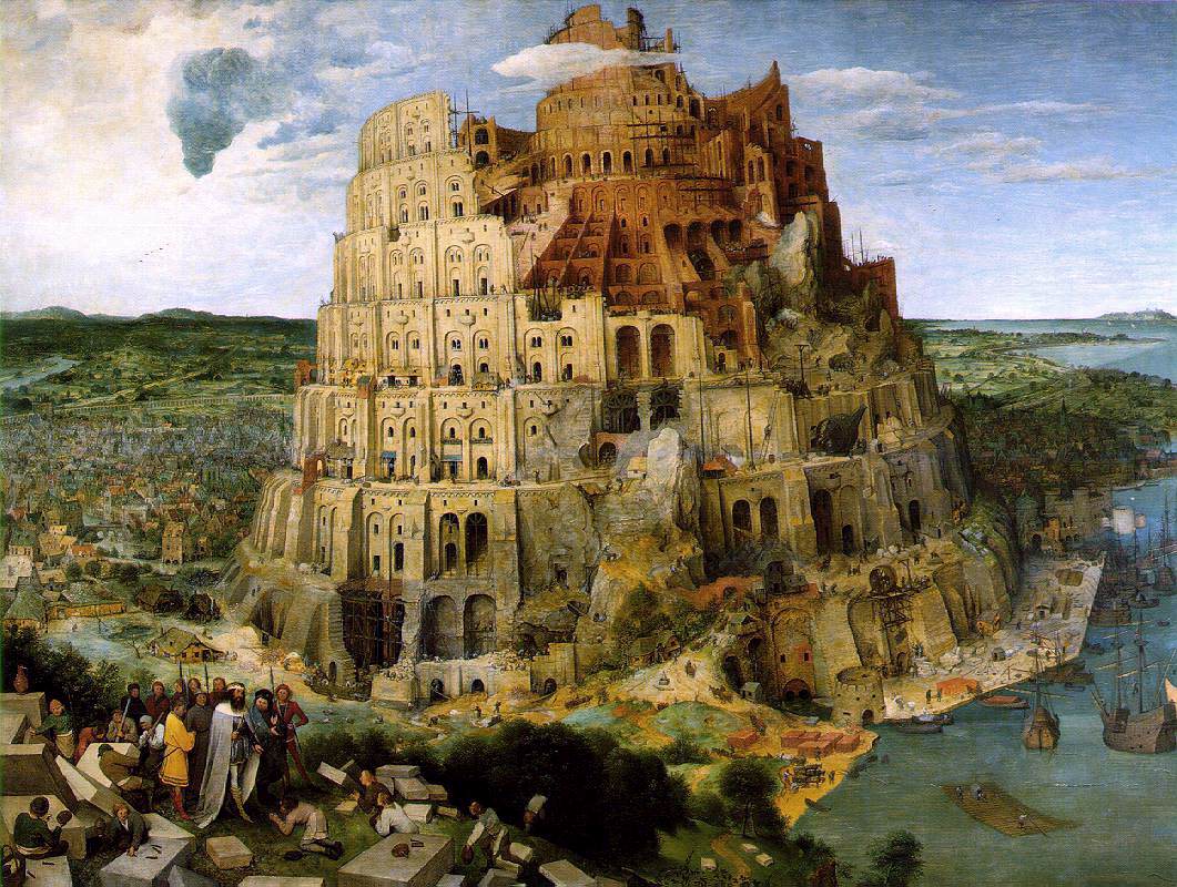
Herodotus claimed the outer walls were 56 miles in length, 80 feet thick and 320 feet high. Wide enough, he said, to allow a four-horse chariot to turn. The inner walls were "not so thick as the first, but hardly less strong." Inside the walls were fortresses and temples containing immense statues of solid gold. Rising above the city was the famous Tower of Babel, a temple to the god Marduk, that seemed to reach to the heavens.

While archaeological examination has disputed some of Herodotus's claims (the outer walls seem to be only 10 miles long and not nearly as high) his narrative does give us a sense of how awesome the features of the city appeared to those that visited it. Interestingly enough, though, one of the city's most spectacular sites is not even mentioned by Herodotus: The Hanging Gardens of Babylon, one of the Seven Wonders of the Ancient World.

Accounts indicate that the garden was built by King Nebuchadnezzar, who ruled the city for 43 years starting in 605 BC (There is a less-reliable, alternative story that the gardens were built by the Assyrian Queen Semiramis during her five year reign starting in 810 BC). This was the height of the city's power and influence and King Nebuchadnezzar constructed an astonishing array of temples, streets, palaces and walls.

According to accounts, the gardens were built to cheer up Nebuchadnezzar's homesick wife, Amyitis. Amyitis, daughter of the king of the Medes, was married to Nebuchadnezzar to create an alliance between the nations. The land she came from, though, was green, rugged and mountainous, and she found the flat, sun-baked terrain of Mesopotamia depressing. The king decided to recreate her homeland by building an artificial mountain with rooftop gardens.

The Hanging Gardens probably did not really "hang" in the sense of being suspended from cables or ropes. The name comes from an inexact translation of the Greek word kremastos or the Latin word pensilis, which mean not just "hanging", but "overhanging" as in the case of a terrace or balcony.

The Greek geographer Strabo, who described the gardens in first century BC, wrote, "It consists of vaulted terraces raised one above another, and resting upon cube-shaped pillars. These are hollow and filled with earth to allow trees of the largest size to be planted. The pillars, the vaults, and terraces are constructed of baked brick and asphalt."

"The ascent to the highest story is by stairs, and at their side are water engines, by means of which persons, appointed expressly for the purpose, are continually employed in raising water from the Euphrates into the garden."

Strabo touchs on what, to the ancients, was probably the most amazing part of the garden. Babylon rarely received rain and for the garden to survive it would have had to been irrigated by using water from the nearby Euphrates River. That meant lifting the water far into the air so it could flow down through the terraces, watering the plants at each level. This was probably done by means of a "chain pump."

A chain pump is two large wheels, one above the other, connected by a chain. On the chain arehung buckets. Below the bottom wheel is a pool with the water source. As the wheel is turned, the buckets dip into the pool and pick up water. The chain then lifts them to the upper wheel, where the buckets are tipped and dumped into an upper pool. The chain then carries the empty ones back down to be refilled.

The pool at the top of the gardens could then be released by gates into channels which acted as artificial streams to water the gardens. The pump wheel below was attached to a shaft and a handle. By turning the handle slaves provided the power to run the contraption.

Construction of the garden wasn't only complicated by getting the water up to the top, but also by having to avoid having the liquid ruin the foundation once it was released. Since stone was difficult to get on the Mesopotamian plain, most of the architecture in Babel utilized brick. The bricks were composed of clay mixed with chopped straw and baked in the sun. The bricks were then joined with bitumen, a slimy substance, which acted as a mortar. These bricks quickly dissolved when soaked with water. For most buildings in Babel this wasn't a problem because rain was so rare. However, the gardens were continually exposed to irrigation and the foundation had to be protected.

Diodorus Siculus, a Greek historian, stated that the platforms on which the garden stood consisted of huge slabs of stone (otherwise unheard of in Babel), covered with layers of reed, asphalt and tiles. Over this was put "a covering with sheets of lead, that the wet which drenched through the earth might not rot the foundation. Upon all these was laid earth of a convenient depth, sufficient for the growth of the greatest trees. When the soil was laid even and smooth, it was planted with all sorts of trees, which both for greatness and beauty might delight the spectators."

How big were the gardens? Diodorus tells us it was about 400 feet wide by 400 feet long and more than 80 feet high. Other accounts indicate the height was equal to the outer city walls. Walls that Herodotus said were 320 feet high.

In any case the gardens were an amazing sight: A green, leafy, artificial mountain rising off the plain. But did it actually exist? After all, Herodotus never mentions it.

This was one of the questions that occurred to German archaeologist Robert Koldewey in 1899. For centuries before that the ancient city of Babel was nothing but a mound of muddy debris. Though unlike many ancient locations, the city's position was well-known, nothing visible remained of its architecture. Koldewey dug on the Babel site for some fourteen years and unearthed many of its features including the outer walls, inner walls, foundation of the Tower of Babel, Nebuchadnezzar's palaces and the wide processional roadway which passed through the heart of the city.

While excavating the Southern Citadel, Koldewey discovered a basement with fourteen large rooms with stone arch ceilings. Ancient records indicated that only two locations in the city had made use of stone, the north wall of the Northern Citadel, and the Hanging Gardens. The north wall of the Northern Citadel had already been found and had, indeed, contained stone. This made it seem likely that Koldewey had found the cellar of the gardens.

He continued exploring the area and discovered many of the features reported by Diodorus. Finally a room was unearthed with three large, strange holes in the floor. Koldewey concluded this had been the location of the chain pumps that raised the water to the garden's roof.

The foundations that Koldewey discovered measured some 100 by 150 feet. Smaller than the measurements described by ancient historians, but still impressive.

While Koldewey was convinced he'd found the gardens, some modern archaeologists call his discovery into question arguing that this location is too far from the river to have be irrigated with the amount of water that would have been required. Also tablets recently found at the site suggest that the location was used for administrative and/or storage purposes, not as a pleasure garden.

Wherever the location of the gardens were, we can only wonder if Queen Amyitis was happy with her fantastic present, or if she continued to pine for the green mountains of her homeland.

Inca Civilisation

 Between 1200 and 1535 AD, the Inca population lived in the part of South America extending from the Equator to the Pacific coast of Chile. The beginning of the Inca rule started with the conquest of the Moche Culture in Peru. The Inca were warriors with a strong and powerful army. Because of the fierceness of their army and their hierarchical organization, they became the largest Native American society. The height of their reign in the 15th century came to a brutal end in 1535 when the Spanish conquistadors took over their territory.
Their cities and fortresses were mostly built on highlands and on the steep slopes of the Andes Mountains. The architecture of the Inca cities still amazes and puzzles most scientists. Stone steps lead up to the top of the cities, which consist of stone houses and religious buildings. The blocks of stones weigh several tons and they are fit together so tightly that not even a razor blade can fit through them. The central city was mainly used for government purposes, while the citizens occupied surrounding areas. Their homes were made from the same stone material and had grass rooftops.
The Inca society was arranged by a strict hierarchical structure. There were many different levels with the Sapa, high priest or ruler, and the army commander at the top. Family members were councilors to the Sapa and even women had authority in the Inca hierarchy. The temple priests, architects and regional army commanders were next. The two lowest classes consisted of artisans, army captains, farmers, and herders. Farmers provided most of the subsistence for the rest of the population. They had to pay tax in the form of gold, which were distributed to the higher classes.
The comprehension of how irrigation can benefit agriculture is evident by the expansion into the highland areas. They developed drainage systems and canals to expand their crop resources. Potatoes, tomatoes, cotton, peanuts and coca were among the many crops grown by the Inca. Llama were used for meat and transportation. There was more than enough resources available for everyone. Increased subsistence levels led to a growth in the Inca population.
Since population was increasing and the organization of the Inca became stronger, the need for protection became necessary. They built enormous fortresses on top of steep mountains that enabled them to see their enemies and defend themselves. One of the most famous Inca fortresses is Sacasahuman (pictured above), located in Cuzco, the Inca Empire capital. Even though the Inca never had access to the wheel, they built a sophisticated road system to connect the villages. The roads were paved with flat stones and barriers to protect the messengers, or chasqui, from falling down the cliff.
The highest point in an Inca village was reserved for religious purposes. This point was the closest to the sun, which represented their major god, Inti, the Sun God. The six major gods of the Inca represent the moon, sun, earth, thunder/lightning and the sea. Pachamama is the earth god, who is the mother of all humans. The Inca had shamans who believed in animal spirits living on earth. Heaven was depicted by the condor, the underworld by the anaconda, and the brother who resided on earth was the puma. The Sun Temple, located in Machu Picchu, Peru, was a religious calendar that marked the winter and summer solstices.
The Inca were not only fierce conquerors but they also had a violent punishment system. If someone stole, murdered, or had sex with a Sapa wife or a Sun Virgin, they were thrown off a cliff, hands cut off or eyes cut out, or hung up to starve to death. Prisons were of no use because punishment usually consisted of death.
Recent excavations of the Inca sites has revealed mummified bodies of the Inca royalty. They have been preserved by ice in the peaks of the Andes mountains.
The Incas had an army which consisted of 40,000 people. The Spanish army in the Americas, which was commanded by Francisco Pizarro, had only 180 people. How could an Army of only 180 defeat an army of 40,000 men? There are three main reasons for this.
1) Much of the Incan army died as a result of smallpox, which was carried to them via the Spanish Conquistadors.
2) The Spanish Conquistadors were able to convince other tribes, already under Incan rule, to side with them and over throw the Incan Empire.
3) The weapons used by Incan warriors ,though effective in tribal warfare, were no match for the Spanish arms.
By 1535, the Inca society was completely overthrown, and Pizarro moved the capital from Cuzco to Lima.


The Incas were a distinct people with a distinct language living in a highland center, Cuzco. They were an ancient people, but had been subject to the regional powers during the entire history of South American urban cultures. They began to expand their influence in the twelfth century and in the early sixteenth century, they exercised control over more territory than any other people had done in South American history. The empire consisted of over one million individuals, spanning a territory stretching from Ecuador to northern Chile.
Unlike the military empires in Central America, the Incas ruled by proxy. After conquering a people, they would incorporate local rulers into their imperial system, generously reward anyone who fought for them, and treated well all those conquered people who cooperated. So, in reality, the Inca "empire," as the invading Spanish called it, was not really an empire. It was more of a confederation of tribes with a single people, the Incas, more or less in control. Each of these tribes was ruled independently by a council of elders; the tribe as a whole gave its allegiance to the ruler, or "Inca." The "Inca" was divine; he was the descendant of the sun-god.
The social structure of the Incas was extremely inflexible. At the top was the Inca who exercised, theoretically, absolute power. Below the Inca was the royal family which consisted of the Inca's immediate family, concubines, and all his children. This royal family was a ruling aristocracy. Each tribe had tribal heads; each clan in each tribe had clan heads. At the very bottom were the common people who were all grouped in squads of ten people each with a single "boss." The social unit, then, was primarily based on cooperation and communality. This guaranteed that there would always be enough for everyone; but the centralization of authority meant that there was no chance of individual advancement (which was not valued). It also meant that the system depended too much on the centralized authority; once the invading Spanish seized the Inca and the ruling family, they were able to conquer the Inca territories with lightening speed. Conquered people were required to pay a labor tax (mita ) to the state; with this labor tax, the Incas built an astonishing network of roads and terraced farmlands throughout the Andes.
Agriculture was tough business in the Andes. The Incas actively set about carving up mountains into terraced farmlands—so successful were they in turning steep mountainsides into terraced farms, that in 1500 there was more land in cultivation in the Andean highlands then there is today. The Incas cultivated corn and potatoes, and raised llama and alpaca for food and for labor.
Of all the urbanized people of the Americas, the Incas were the most brilliant engineers. The Huari-Tiahuanaco performed amazing feats of fitting gigantic stones together, and the Nazca designed mind-numbingly huge earth-drawings that still exist today. But the Inca built massive forts with stone slabs so perfectly cut that they didn't require mortar—and they're still standing today in near-perfect condition. They built roads through the mountains from Ecuador to Chile with tunnels and bridges. They also built aqueducts to their cities as the Romans had. And of all ancient peoples, they were the most advanced in medicine and surgery.
The language they spoke was Quechua which they imposed on all the peoples they conquered. Because of this, Quechua is still spoken among large numbers of Native Americans throughout the Andes. They had no writing system at all, but they kept records on various colored knotted cords, or quipu .
The central god of the Incan religion was the sun-god, the only god that had temples built for him. The sun-god was the father of the royal family. There were many gods among the Incas, but the sun-god outshone them all. The Incas also believed that there was a heaven, a hell, and a resurrection of the body after death.
At its height, the Inca civilization crashed into the European expansion. In 1521, Herman Cortés conquered the Aztecs; this conquest inspired Francisco Pizzarro to invade the Incas in 1531. He only had two hundred soldiers, barely enough to walk the dog. However, he convinced the ruler of the Incas, Atahualpa, to come to a conference at the city of Cajamarca. When Atahualpa arrived, Pizzarro kidnapped him and killed several hundred of his family and followers. Atahualpa tried to ransom himself, but Pizzarro tried to use him as a puppet ruler. When that failed, Pizzarro simply executed him in 1533. Over the next thirty years the Spanish struggled against various insurrections, but, with the help of native allies, they finally gained control of the Inca empire in the 1560's.


source 1 2

Sodom and Gomorrah


Introduction


This article has been rewritten (2007) due to new research and development surrounding the sites of Sodom and Gomorrah. The names Sodom and Gomorrah have long been associated with God's judgment of sin. The word sodomy is still found in the English language as a legal term for unnatural sexual acts. To many, these names are only stories or myths from out of the past. Sodom and Gomorrah, however, were a part of a larger agricultural confederation of cities known as the Cities of the Plain (Gen 13:12, 13) and as historical as Nineveh, Ur or Jerusaelem. The five Cities of the Plain included Sodom, Gomorrah, Zoar, Admah and Zeboim (Gen 19:22).

Location

The search for the Cities of the Plain begins with some scholars saying they were non-existent. (1918 - W. F. Albright; 1948 - Martin Noth and finally Theodor Noldeke). Noldeke's rejection was based upon the idea that no route east of the Jordan River existed, as was described in the Biblical account. Evidence to support ancient eastern travel in Abraham's day was discovered in a clay tablet from Babylonia, and also from a group of tablets found near the edge of present day Syria, at the site of the ancient city of Mari. On the Babylonian tablet a contract was found with the stipulation that a wagon was rented on condition that it was not driven to the Mediterranean coast.
Later, the actual route was found by Nelson Glueck. For awhile the discovery of the Ebla tablets in 1974 were reported to reveal the historical existence of the Cities of the Plain. University of Rome excavators, Giovanni Pettinato and Paolo Matthiae translated tablets taken from Ebla (Tell Mardikh) and report that on one of the tablets a trade list is recorded which includes the Cities of the Plain (David Freedman 1978). However, most scholars today doubt these readings. Sadly, Pettinato and Matthiae have taken opposite sides over this issue ending their working relationship. The Ebla tables play an important role in biblical studies as they shed light on Palestinian life in the 3rd millennium BC.

Early Attempts

In 1924 W. F. Albright, led an expedition in order to locate the Cities of the Plain. After an investigation of the area with little success, Albright concluded that the Cities of the Plain were swallowed up by the Dead Sea as it swelled with water and they were covered forever. This theory was further substantiated by Ralph E. Baney's discovery in 1960 of a small tree in the growth position beneath the southern basin of the Dead Sea. This showed that the continuous filling of the Dead Sea had taken land which was once exposed, supporting W. F. Albright's theory. Albright did, however, find the ruins of a great fortress, Bab edh-Dhra, built of stone overlooking the deep ravine of Wadi Kerak. Taking into consideration the lack of occupational debris and seven fallen limestone monoliths found a short distance east of Bab edh-Dhra, Albright concluded that this was a place of pilgrimage where annual feasts were celebrated. He concluded that Bab edh-Dhra was directly related to the Cities of the Plain because it was unoccupied about the time the Cities of the Plain were destroyed 2000 B.C. or a little earlier. However, Bab edh-Dhra's date of destruction is now confirmed at about 2350 B.C. for the fortified town and about 2250 B.C. for the unwalled rebuild, likely putting it out of chronological range for the time of Abraham and Lot.

New Discoveries

Between 1965 and 1967 Bab edh-Dhra was excavated under the direction of Paul Lapp. Much work was done at a large cemetery south of the city. It was more than five-eighths of a mile in length and at least half that wide. If the work which was done is typical, the area may contain a minimum of 20,000 shaft tombs estimating the dead at over half a million and the number of potsherds at two million!
Unfortunately, Paul Lapp died unexpectedly in 1970 and the task of further research fell to R. Thomas Schaub and Walter E. Rast. They set out to answer some unanswered questions about Bab edh-Dhra. In late May, 1973, they began to examine some similarities between pottery from Bab edh-Dhra and pottery found at Safi and Feifa.
In first examining the Feifa site they discovered a burial ground which could compete with Bab edh-Dhra in size and usage. Then they found the remains of a city wall and a tower. Early Bronze Age 3000-2350 B.C. pottery was also discovered which placed this ruin in the same time period as Bab edh-Dhra. Feifa was discovered on the north side of the Wadi Feifa.
While exploring the Wadi south of Bab edh-Dhra, Schaub and Rast came upon another early bronze fortification. Numeira was also located on a level top of a plain just south of the spring, Wadi Numeira.
There was a pattern forming. Each of the early bronze sites was discovered built on a piece of ground overlooking a Wadi (ravine), enclosed by a stone wall with a tower at one end, and situated near a spring.
Now knowing what to look for, Schaub and Rast combed the area between Lisan in the north to the Southern tip of the Ghor between Numeira and Feifa. They found Safi located on a piece of limestone overlooking the Wadi Hesa where they found early bronze pottery. They again found a cemetery that could compete with Bab edh-Dhra and Feifa in size and kind. The last early bronze site to be discovered was Khanazir, the southern most city located on the northern side of the Wadi Khanazir. This site has all of the common characteristics of the other four sites with the exception of the cemetery.
Dr. Steven Collins of Trinity Southwest University proposes that Tall el-Hammam in central Jordan is the location of Sodom. This is the largest Middle Bronze Age site in the region north of the Dead Sea. Evidence suggests that it was not occupied for over five centuries (late Iron Age 1000-586 BC) following its destruction in the Middle Bronze Age (2000-1550 BC). Dr. Collins began excavations at the site in 2005-2006 and has not discovered any Late Bronze Age (1550-1000 BC) pottery.. He argues that Bab edh-Dhra could not be the site of Sodom because "Bab edh-Dhra was destroyed several hundred years before Abraham and Lot were ever born, and besides, it's entirely in the wrong place!" The strength of the northern location is supported by the Biblical descripiton of the geography (Gen 13:3) which was argued by all archaeologists prior to Albright. The Archaeological Study Bible identifies Tall el-Hammam as Shittim (location of Israel's encampment prior to entering the promised land) however gives no archaeological evidence for this identification (p 233). In Moses day the region of Sodom was described as a "Wasteland below Pisgah" (Num. 21:20).

Idenifying the Sites

In Genesis 13:3 that Abraham and Lot were in the region between Bethel and Ai when they picked out the location of the Land. The plain of Jordan just in front of Jericho would be visible from this mountainous location.
In Genesis 13:10 the description of the area of land Lot chose is described as, "Lot looked up and saw that the whole plain of the Jordan was well watered, like the garden of the LORD, like the land of Egypt, towards Zoar" (Gen 13:10 NIV). The Plain of Jordan is a unique Hebrew word (kikkar) usually meaning "round loaf of bread" or "round coin". It is only used for a geographic location in the Bible for the plain of Jordan (Gen 13:10-12; 19:17; 19:25, 28-29; Deut 34:3; 1 Kg 7:46; 2 Ch 4:17; 2 Sam 18:23) and used for the circular area around Jerusalem (Neh 3:22 12:28). The term can be translated circular district (BDB Lexicon, Whittaker). The location that best fits this description is at the north end of the Dead Sea known as the plain of Jordan. The other Hebrew term used to describe the area is kullahh mashgeh which literally means to be "completely and totally irrigated". It was this area which was "well watered" like the garden of God and the Nile (Gen. 13:10).
The grapes of Sodom and Gomorrah are referred to in Deuteronomy 32:32 and the sin of Sodom mentioned in Ezekiel 16:49 indicates that they were over-fed. Christ describes the condition of Sodom as people "eating and drinking, buying and selling, planting and building" (Luke 17:28 NIV).
The phrase, Cities of the Plain, in Genesis 13:12 and 19:29 is in what is known in Hebrew as the "construct state". This means that the word cities has a very close association with word plain.
The Biblical text requires that the location of the cities be located on the eastern side of the round district of the Jordan Valley and would need to be well watered and visible from the mountains around Bethel and Ai. Tall el-Hammam fits this description perfectly.

Reconstruction of Destruction

The account of the destruction of all the Cities of the Plain except Zoar is given in Genesis 19:23-25. "By the time Lot reached Zoar, the sun had risen over the land. 24 Then the LORD rained down burning sulfur on Sodom and Gomorrah-- from the LORD out of the heavens. 25 Thus he overthrew those cities and the entire plain, including all those living in the cities-- and also the vegetation in the land" (Gen 19:23-25). From the research of geologist Frederick G. Clapp, who visited the area in 1929 and 1934, it was discovered that there are fault lines along the east and west sides of the Dead Sea. The Cities of the Plain would lie at the edge of the valley of Jordan along the eastern fault line. Also, earthquakes are common to the area. In Clapp's research, asphalt and petroleum accompanied by natural gas were found in the area. From Genesis 14:10, it is evident that the valley of Siddim was full of tar pits. This tar is naturally occurring asphalt (Gen 11:3; Exodus 2:3). With the assistance of the imagination, the destruction of the Cities of the Plain can be recreated. Bryant Wood speculates that, "these combustible materials could have been forced from the earth by subterranean pressure brought about by an earthquake resulting from the shifting of the bounding faults. If these combustibles were ignited by lightning or some other agency as they came spewing forth from the ground, it would indeed result in a holocaust such as described in Genesis 19." One would expect to find wide spread burning in the area. From the 1973 report by Rast and Schaub there is evidence of widespread burning in the case of three of the cities. At Numeira, a pit was dug which cut through a seven foot thick layer of dark ash and at Feifa, much the same evidence of destruction by fire could be found (Gen 19:28).
However, there is also evidence of severe burning at Tall el-Hammam at the Middle Bronze Age level, which is closer to the time of Abraham and Lot. This has been verified by the recent excavations led by Dr. Steve Collins at Tall el-Hammam.

Matching the Cities

The question then is it possible to identify the Cities of the Plain with archaeological sites today? Traditionally the name of Zoar has remained since Bible times as the site on the Wadi Hesa near modern es-Safi identified on the Madaba map in the church in Madaba, Jordan. This beautiful mosaic depicts the region of the Holy Land during the 6th century BC and places Zoar at this location. However no archaeological evidence has been uncovered to indicate that this site is Zoar. In fact there is no remains earlier than the Hellenistic Period. Dr. Bryant Wood has identified the cities of Bab edh-Dhra as Sodom, Numeira as Gomorrah, es-Safi as Zoar, Feifa as Admah, and Khanazir as Zeboiim. However, the dates of the destruction in the Early Bronze age does not match the period of Abraham (Hyksos period held by Kitchen, Collins and Chavalas) who may have entered Canaan about 1875 BC with Sodom being destroyed sometime later. Also recent geological studies of the Dead Sea indicate that the southern tip of the Dead sea (Lisan) was never a well-watered plain nor ever shaped in a circle. Given the geographical characteristics of the northern end of the Dead Sea and recent discoveries at Tall el-Hammam it may be wise to rethink the locations of the five cities of the plain in the southern end of the Dead Sea.

Reconstruction of Life

From the Biblical account, we know of their wickedness. Also the residence of Sodom "were eating and drinking, buying and selling, planting and building" (Luke 17:28 NIV). One would expect to find evidence of trade, commerce, and agriculture.

Occupations

Many of the people would be occupied with the agriculture which was so vital to the five cities. Many would be involved with tomb cutting which required professional workmanship to accomplish. Others would be professional potters as is evident from the quality of pottery found in the region at various sites. Some, like Abraham and Lot raised flocks and herds and there are other occupations which are necessary for sustaining life in this form of community such as spinners and weavers, builders, tentmakers, craftsmen, artisans, merchants, etc.

Religious Beliefs

It has already been mentioned that the people were extremely wicked. The site of the five cities of the Plain should reveal cultic object and likely fertility figurines.

Significance of Discoveries

The discoveries at Tall el-Hammam are soon to be published, and may shed significant light on the debate over the location of ancient Sodom and the five cities of the plain. If the destruction of these cities can be dated to the general period of the Patriarchs, we will have the first historical date for Abraham. This new information may help fill in the chronological structure of history prior to Solomon.

Conclusion

Throughout Bible history Sodom and Gomorrah have stood out as important examples of God's punishment on sin. Jesus even used these cities to reveal His coming in Luke 17:28-30. "It was the same in the days of Lot. People were eating and drinking, buying and selling, planting and building. 29 But the day Lot left Sodom, fire and sulfur rained down from heaven and destroyed them all. 30 'It will be just like this on the day the Son of Man is revealed. 31 On that day no one who is on the roof of his house, with his goods inside, should go down to get them. Likewise, no one in the field should go back for anything. 32 Remember Lot's wife!' " (Luke 17:28-32 NIV). The cities of Sodom and Gomorrah are a warning to our own society as it goes about its business, all the while rejecting and disobeying God.